
Fishing the 61 Lakes, Ponds and Puddles of Brown County Indiana
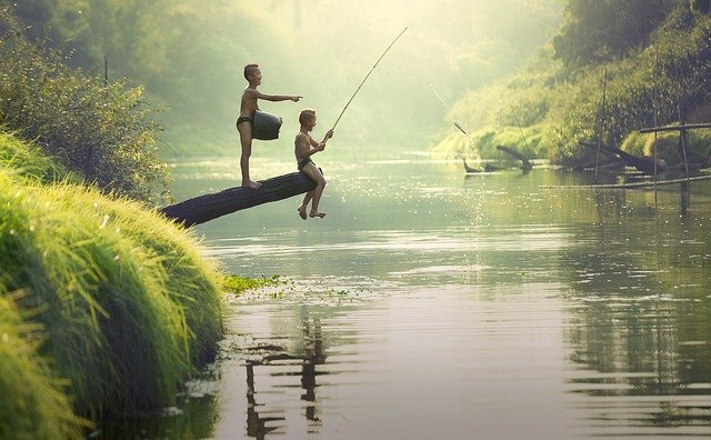
Fishing the 61 Lakes, Ponds and Puddles of Brown County Indiana

Fishing the 61 Lakes, Ponds and Puddles in Brown County Indiana
DISCLAIMER: There are only 3 lakes, ponds or puddles in Brown County where the public can fish. All other lakes, ponds or puddles are on private property and you will need permission to fish on their property before you show up. We do not know who these private owners are nor do we know how to contact them. We compiled this list of lakes and ponds by looking at Google Earth and Google Maps, our own research and from our own experience living in Brown County Indiana. Please contact these private owners before you visit their property. TRESPASSING IS ILLEGAL IN INDIANA AND CAN RESULT IN ARRESTS OR FINES. DON'T TAKE YOUR CHANCES. THE PROPERTY OWNERS AND MANAGERS WILL CALL THE POLICE ON YOU AND HAVE YOU ARRESTED.
Brown County Indiana with it's 60 plus lakes, ponds and puddles, should be a great place to go fishing. It is a great place to go fishing but in reality BC only has 3 lakes open to the public for fishing whereas inside the Indianapolis city limits one can find 11 lakes open to the public for fishing. Here is our guide to all 61 Lakes, Ponds and Puddles in Brown County Indiana.
We did not set out to compare the fishing between downtown Indianapolis to Brown County Indiana but that is what this article turned out to be. When we started writing this article, we thought it would be informative to let folks know of all the different and wonderful fishing places in Brown County Indiana. Boy did this story take a twist. Growing up in Brown County and living here now, we just knew there were so many places to fish in Brown County. We just knew. In our research we certainly did find a large number of lakes and twice as many ponds as lakes in Brown County.
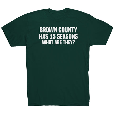
There are lakes, ponds and puddles all over Brown County. Practically every hillside and valley have a least one or the other. In our comprehensive list of the best places to fish in Brown County listed below, we discovered 61 lakes and at least 2 ponds (that have official names). The more research we did about places to fish in Brown County, however, we discovered something interesting about “What we just knew”. What we “Just Knew” turned out to be “not so sure” after all.
As far as fishing goes, hands down, “inside the city limits of Indianapolis” beats Brown County Indiana.
WAIT - WHAT?
Yes. Inside the city limits of Indianapolis, they have more places for the public to fish than you can find in Brown County even though Brown County has 6 times more lakes than inside the city limits of Indianapolis Indiana.
Related Products


Fun Guy T-Shirt | Unisex Tee
$31.00


That Don’t Sound Right. How Can That Be?
I grew up in Brown County and there was never a shortage of places to fish. If we wanted to go fish a lake someplace, we did. We could park anywhere we wanted, drive down any lane or jeep trail we wanted, climb a hill or hike across any field we wanted. And no one ever said a word. Mostly because there was no one around to see or say a word, nor did they care. Most of the time when someone saw a car parked “out there” they knew someone was either fishing, or mushroom hunting. In November, they might be game hunting. If someone said anything it might be “did you catch any?” or “How big was the one that got away” or "Did you catch any catfish".
But that was a couple decades ago. There are a lot more people living in Brown County now, compared to the 1980’s and earlier. The lakes and ponds that no one used to live near, are now surrounded with housing developments and private property. Now all that free range fishing we used to have access to, that everyone took for granted, is now private property, usually protected with security cameras, security lights, security fences, private security systems and a police force that is 5 times larger than it used to be back then. We often ask when we drive by the Jail, why is the Brown County Jail so large when nothing ever happens in Brown County? What kind of crime could there possibly be in Brown County? It beat’s me. I can’t think of any crime in Brown County at least I never hear of any.
Well there is that one person who likes to throw their 32 ounce blue and white plastic mountain dew drink mug out along the road. We'll get them one of these days. Just a matter of time. But that is another story.
Back to Our Research
We thought it would be a slam dunk win for our list of places to fish in Brown County. We thought it would make a good list if we listed all the places to fish in Brown County. However, our research showed this not be the case. Brown County certainly has far more lakes, ponds and puddles than Indianapolis. It ‘Could” be a great place to go fishing. Brown County has, as best as we can count, 61 lakes, and 2 official ponds and countless additional unnamed ponds and certainly a few puddles and not to mention Salt Creek. All of these lakes and ponds are located in some pretty scenic country. Brown County could be an awesome place to go fishing. Of this total, only 4 lakes are open to the public for fishing because they are owned by the state. By contrast inside the city limits of Indianapolis, there are 11 lakes. Every one of which are open to the public for fishing. If I do the math, 11 divided by 4 and round up, we could say, “Indianapolis has 3 times as many places to fish than Brown County”.
It kind of makes sense. In the old days, one could buy a fishing rod and reel, line, hooks, a few bobbers, sinkers and bait at just about any of the several general stores in the county. Now days, if you need fishing gear or bait, you need to drive to Columbus or Bloomington to buy fishing gear or bait. Since there are so few places for the public to fish in the county, there are no shops that sell fishing gear or bait, at least none that I know of. Maybe that will change in the future.
I view “going fishing” in Brown County as a lost opportunity for the county and the lake owners. If more private land owners opened their lakes up for the public to fish, perhaps a small cottage industry would spring up.
Our Blog Was A Bust. A Big Fizzler. How Are We Going to Save This Thing?
Even if you can’t fish, Brown County is still a popular day trip destination. The problem most people have is where to drive to when they do come to Brown County for a day trip. What we do in the rest of this blog is give you driving directions to each of the Lakes, Ponds and Puddles in our Comprehensive Fishing guide for Brown County. That is one short, sad, list. We were always going to do that because most of these lakes and ponds have no address or owner contact information. The only way to get to them or to know where they are at is to follow someone’s verbal directions. Where we have additional details about each lake, we list those in a convenient table. Hopefully over time, as readers give us updates, we will be able to add more information about each Lake, Pond or Puddle in Brown County.
Places to Fish in Indianapolis
These 11 lakes inside the Indianapolis city limits are open to the public for fishing:
| Fishing | Boating | Camping | Public Access |
| Y | ? | ? | Y |
· Riverside Park
· Krannert Park
· Delaware Lake
· Meadowlark Park
· Broad Ripple Park
· Marott Park
· Holliday Park
· Southwestway Park
· Eagle Creek Reservoir
You will need a fishing license to legally fish in Indiana.
Where Can You Go Fishing In Brown County?
Brown County Indiana is home to many scenic lakes, ponds, and puddles. If you are looking for a wonderful place to go boating, fishing, sailing, scuba diving, swimming, creek fishing, rock skipping and last but not least the occasional skinny dip (er hum), then come on down to Brown County.

To get to Brown County Indiana, there are several ways to get here.
From Indianapolis, take I-65 south to Exit 68 at Columbus interchange. Turn right and head west on State Road 46 for about 16 miles into Nashville.
Also from Indianapolis, take State Road 135 South for about 33 miles and you will come right into Nashville Indiana. This route takes you through Trafalgar and Morgantown. This route by itself is a wonderful drive and I do it whenever I am not pressed for time.
Finally, from Indianapolis, take I-69 south to Bloomington, get off at second street and work your way east on State Road 46 for about 18 miles or so and you will go directly into Nashville that way too.
So how many Lakes, Ponds and Puddles are in Brown County Indiana?
As best as we can count, there are at least 61 Lakes in Brown County Indiana. There are at least 2 named ponds, dozens of unnamed ponds and a whole bunch of puddles that are smaller than ponds. Sounds like a summer swimmers paradise. Grab your trunks and come on down!
Now hold on, not all of these 61 Lakes, Ponds and Puddles are open to the public. Most of them (all but 3) are on private property and that means you will need permission to get access to them or an angry owner might call the police on you for trespassing.
Just because they are on private lands, does not mean they cannot be a Brown County destination. With the exception of a few that you have to hike into, most of the lakes, ponds and puddles can at least be driven to.
So, if you are wanting to take a nice scenic drive through Brown County either in a Jeep, a nice air-conditioned land cruiser, on a bike, or a motorcycle, each of the Lakes, Ponds and Puddles in our Comprehensive List of the Lakes, Ponds and Puddles of Brown County are perfect day trip driving destinations. Many of these lakes are really remote, so pack a sandwich and some drinks before you head out. Make sure you have plenty of gas in your tank too. A hat, long sleeves, pants and boots are the usual attire for being in the woods.
In our Lakes, Ponds and Puddles guide, I give you driving directions to each Lake, Pond or Puddle in our directory. Since I am from Brown County, I know all the back road in the county. Many of the roads are not even listed on a map since they are too small to be listed or are simply an old jeep or wagon trail.
All directions to a Brown County Lake, Pond or Puddle starts out at Nashville. I don’t give exact distances because I thought that would be boring. “About a mile” means the same as 0.8, 0.9, 1.0, 1.1 or 1.25 miles. I don’t have a yard stick. I just know, when I go to that lake or pond, these are the land marks I usually look for. I could not really tell you the last time I actually measured a distance on the Odometer as it’s not really that important. When you get to a certain place, like bean Blossom, you will know you are at Bean Blossom and to be on the lookout for your turn for example.
Some driving routes are more difficult than others so I have rated the driving difficulty to each Lake. All driving routes are different in driving length. My only measurement has been “about that far”.
Be sure to send us a picture if you do head out and we will post it with each Lake, Pond and Puddle driving destination that you made it to.
COMPREHENSIVE FISHING GUIDE FOR BROWN COUNTY INDIANA
Aspen Lake
| Fishing | Boating | Camping | Public Access |
| N | N | N | N |
Driving Difficulty: 3
Private: Yes
5 Acre Lake
Drive 15 minutes north of Nashville on State Road 135 North to Fruitdale. Turn right and drive east on East Fruitdale Road, Go about a mile and turn left onto Vinkaya Drive and drive north about half a mile. There you will find Aspen Lake House
Reservations: For Reservations contact Hills O’Brown Vacation Rentals
Phone: 1-812-988-6429
Ode Lake
| Fishing | Boating | Camping | Public Access |
| N | N | N | N |
Driving Difficulty: 3
Private: Yes
From Nashville Drive East on East Main Street to the bottom of the first hill and turn left on Greasy Creek Road. Drive North on Greasy Creek Road approximately 4 miles to Shilo Morning Drive. Turn Left and drive north on Shilo Morning Drive to Ode Lake. If you overshoot and come to State Road 135 you have gone about 1 mile too far.
Greenbrier Lake
| Fishing | Boating | Camping | Public Access |
| N | N | N | N |
Driving Difficulty: 3
Private: Yes
From Nashville Drive East on East Main Street to the bottom of the first hill and turn left on Greasy Creek Road. Drive North on Greasy Creek Road approximately 2 miles to Creamer Road. Turn right onto Creamer Road and drive about 1 mile to the end of the road. Greenbrier Lake is at the end of the road.
Peoga Lake
| Fishing | Boating | Camping | Public Access |
| N | N | N | N |
Driving Difficulty: 4
Private: Yes
From Nashville Drive East on State Road 46 approximately 3 miles to the Shell Gas Station. Turn Left onto Salt Creek Road. Drive north on Salt Creek Road about 4 miles to Gatesville. Turn right at Gatesville onto Gatesville Road and drive about a quarter mile. From Gatesville Turn north onto Sweetwater Trail Road. Drive north on Sweetwater Trail Road about 5 miles to South Peoga Road. The road will change names here from S 250 West and South Peoga Road. Go east on Peoga Road to West Peogo Lake Drive. Peoga Lake is approximately a mile long and runs parallel to West Peoga Lake Drive.
Green Lake
| Fishing | Boating | Camping | Public Access |
| N | N | N | N |
Driving Difficulty: 4
Private: Yes
From Nashville drive north on 135 North approximately 4 miles to BeanBlossom. As you come off the big hill into BeanBlossom at the bottom of the hill turn right on Gatesville Road. Drive about 4 miles east on Gatesville Road to Upper Salt Creek Road. Turn left on Upper Salt Creek Road. Drive north on Upper Salt Creek Road about 4 miles to Green Road. The road will split at this point to Gold Point Road and Green Road. Turn right onto Green Road. Drive east on Green Road to Green Lake Drive. Turn right onto Green Lake Drive and Green Lake is to the south side of Green Lake Drive.
Woodland Lake
| Fishing | Boating | Camping | Public Access |
| N | N | N | N |
Driving Difficulty: 3
Private: Yes
From Nashville drive north on 135 North approximately 4 miles to BeanBlossom. Turn right onto Spearsville Road. Drive north east on Spearsville Road about 1 mile. Turn right onto Woodland Lake Road. Continue East on Woodland Lake Road about 1 mile to East Woodland Lake Road. Go about half a mile to North West Shore Drive and turn right. Go south on North West Shore drive to Woodland Lake. North West Shore Drive circles Woodland Lake.
Little Fox Lake
| Fishing | Boating | Camping | Public Access |
| N | N | N | N |
Driving Difficulty: 3
Private: Yes
From Nashville drive north on 135 North approximately 4 miles to BeanBlossom. Turn right onto Spearsville Road. Drive north east on Spearsville Road about 1 mile. Turn right onto Woodland Lake Road. Continue East on Woodland Lake Road about 1 mile to Bittersweet Road. Turn right onto Bittersweet Road and go south approximately 1 mile to Little Fox Lake Drive which you will find on the left side of the road. Little Fox Lake circles Little Fox Lake.
Smith Lake
| Fishing | Boating | Camping | Public Access |
| N | N | N | N |
Driving Difficulty: 4
Private: Yes
From Nashville drive north on 135 North approximately 4 miles to BeanBlossom. Turn right onto Spearsville Road. Drive north east on Spearsville Road about 1 mile. Turn right onto Woodland Lake Road. Continue East on Woodland Lake Road about 1 mile to Bittersweet Road. Turn right onto Bittersweet Road and go south approximately 1 mile to Little Fox Lake Drive which you will find on the left side of the road. Turn Left onto Little Fox Lake Drive. Little Fox Lake Road will make a sharp right turn to the right. Make the sharp turn and continue south about a quarter of a mile. Smith Lake is to the left side of Little Fox Lake Drive. Little Fox Lake Drive drives between both Smith Lake to the east and Little Fox Lake to the west.
Lost Lake
| Fishing | Boating | Camping | Public Access |
| N | N | N | N |
Driving Difficulty: 4
Private: Yes
From Nashville drive east on Start Road 46 East about 7 miles. Pass through Gnawbone and continue east for another 3 or 4 miles until you find North Nelson Ridge Road on the left. Turn left onto North Nelson Ridge Road (I think it is at the top of a hill). Drive north on North Nelson Ridge Road about a mile and a half to Georgetown Road. Turn left on East George Town Road and drive west about a quarter of a mile or so. You should see North Lost Lake Road on the right-hand side of the road. North Lost Lake Road loops around Lost Lake and reconnects back up with East George Town Road. So you should be able to see Lost Lake on your left as you drive around North Lost Lake Road.
Ogle Lake
| Fishing | Boating | Camping | Public Access |
| Y | ? | ? | Y |
Driving Difficulty: 4
Private: No
Fishing Allowed: Yes
State Fishing License Required: Yes
From Nashville drive east on Start Road 46 approximately 3 miles until you see the sign for Brown County State Park and the Covered Bridge on the right-hand side of the road. If you make it to the golf course you have gone too far. Turn around and go back a half mile. Go through the covered bridge. At the park gate pay your entrance fee and ask for a Map. Proceed south on the Main Road. In about a quarter mile you will come to East Road, Main Road split. Continue to the right on Main Road. Main Road will eventually meet back up with East Road. Continue south on East Road for about a quarter mile more. Turn right onto Ogle Lake Road. Drive about a mile or less to the end of the road. You are at the parking lot for Ogle Lake which is located inside The Brown County State Park.
17 Acre Lake
Fishing is allowed. Not sure about boating. Swimming is prohibited. Lake has Bass and Bluegill.
You need a fishing license. Got to INHuntFish.com to buy a license online.
Call: 1-317-232-4200 for more information.
Alternate Route: We used to go this way, until we couldn’t.
Driving Difficulty: 6
Private: No
Fishing Allowed: Yes
State Fishing License Required: Yes
From Nashville drive west on State Road 46 at CVS pharmacy for 3 and a half miles. About 2 miles from town, you will climb up this big tall hill. At the top of the hill on the Left will be the west park entrance to Brown County State Park. The top of the hill will flatten out but is really windy back and forth. Finally, you will come to the very top of the hill and there will be a large look out area on the left. You cannot park there or take pictures or the police will give you a ticket. The hill drops off from there and you will have to ride your brakes or gear down all the way to the bottom of the hill because the speed limit is still 45 miles per hour. At the very bottom of the hill, you will be turning left. Turn left onto Upper Schooner Road. Upper Schooner Road ends at Ogle Lake. You can’t really get to the parking lot from this route since it ends in private property. If you wanted to park and fish at Ogle Lake you will have to use the North Park Entrance and go there from inside the park.
Strahl Lake
| Fishing | Boating | Camping | Public Access |
| Y | ? | ? | Y |
Driving Difficulty: 4
Private: No
Fishing Allowed: Yes
State Fishing License Required: Yes
From Nashville drive east on Start Road 46 approximately 3 miles until you see the sign for Brown County State Park and the Covered Bridge on the right-hand side of the road. Go through the covered bridge. At the park gate pay your entrance fee and ask for a Map. Follow the map to Ogle Lake. It is about 2 miles inside the park on the western side of the park.
7 Acre Lake
Fishing is allowed. Not sure about boating. Swimming is prohibited. Lake has Bass and Bluegill.
You need a fishing license. Got to INHuntFish.com to buy a license online.
Call: 1-317-232-4200 for more information.
Black Oak Pond
| Fishing | Boating | Camping | Public Access |
| N | N | N | N |
Driving Difficulty: 6
Private: Yes
From Nashville drive east on State Road 46, 4 miles to State Road 135 South. Drive south on State Road 135 about 5 miles to Stone Head. The head has been stollen and there is an old house directly infront of you and a bridge and large hickory tree on your right. Turn left and drive east on West Bellsville Pike. The first little town you come too is called Pikes Peak and there is a big old church there on the left. Continue through Pikes Peak. At the east edge of town (There are only about 10 houses in Pikes Peak) turn right at Popular Grove Road. Go over the bridge and up the big hill and drive south on Popular Grove Road to the very top of the big hill. Turn sharp left on Popular Grove Road and continue on Popular Grove Road. Do not continue straight onto Hamilton Creek Road. Go about 2 miles further on Popular Grove Road. It will make a sharp left but you should turn right onto Keith Donaldson Road. Continue on Keith Donaldson Road about 1 mile to its end. Turn left onto South Becks Grove Road and go about a quarter of a mile to South Garrity Road. Turn right onto South Garrity Road. It’s a dirt road. Follow Garrity Road about 1 mile until it T’s at Kentucky Avenue. Turn left and continue on Garrity Road. Garrity Road will come to another T in about a quarter of a mile. Turn right onto Lutheran Lake Road. Follow Lutheran Lake Road about 3/4 of a mile to Nathan’s Row. Turn right onto Nathan’s Row. Follow Nathan’s Row south about a quarter of a mile to Heathers Pass. Turn right onto Heathers Pass. Drive west on Heathers Pass about another quarter mile to Andreas Path. Turn left onto Andreas Path and follow it until it dead ends. Now walk about a quarter mile south west through the woods to Black Oak Pond.
Bear Lake
| Fishing | Boating | Camping | Public Access |
| N | N | N | N |
Driving Difficulty: 3
Private: Yes
From Nashville drive north on State Road 135 North approximately 5 miles to Beanblossom. Turn left onto State Road 45 and drive west. In about 2 miles you will come to Helmsburg. kind of an industrial type town with a sawmill on the right. Drive through Helmsburg. In about 2 more miles you will come to a small road on the right-hand side of the road called Bear Creek Road.Turn right and drive north on Bear Creek Road. Drive about 2 miles north on Bear Creek road. The road will come to a fork at Richards Road. Continue left onto Bear Creek road and go about a quarter of a mile. Bear Lake is on the left hand side of the road and should be visible form the road.
Lake Lemon
| Fishing | Boating | Camping | Public Access |
| N | N | N | N |
Driving Difficulty: 5
Private: Yes
From Nashville drive north on State Road 135 North approximately 5 miles to Beanblossom. Turn left onto State Road 45 and drive west. In about 2 miles you will come to Helmsburg. It’s kind of an industrial type town with a sawmill on the right. Drive through Helmsburg. In about 2 more miles you will come to a small road on the right-hand side of the road called Bear Creek Road. Turn right and turn onto Bear Creek Road. After 50 feet or so, look for a road on the left called North Shore Drive. Turn left onto North Shore Drive. North Shore Drive runs the whole length of Lake Lemon and will dead end in about 2 miles. It dead ends at the Lake Lemon dam. Just about any road to the south on your left while on North Shore Drive will take you to someplace on Lake Lemon.
If you want to go to the south side of Lake Lemon, continue on State Road 45 past Bear Creek Road another half mile. Look on your right for a road called South Shore Drive. It should be the second road past Bear Creek Road. South Shore Drive also follows the length of Lake Lemon.
Yellowwood Lake
| Fishing | Boating | Camping | Public Access |
| Y | ? | Y | Y |
Driving Difficulty: 4
Private: No
From Nashville leave town south on State Road 46 toward Bloomington. Go about 7 miles west on Start Road 46. Just after the speed limit changes from 45 MPH to 55 MPH about a mile after that there will be a small grocery story with some garbage collection trucks and bins on the right and directly in front of this store will be a small saw mill that makes wooden pallets. At the store, you will be turning right and on the right-hand side of the road should be a sign that says “Yellowwood State Forest”. Turn right onto Yellowwood Road. In about a mile, Yellowwood Road will meet Green Valley Road. Turn left and continue onto Yellowwood Road. You are only about a mile from Yellowwood Lake. Once you reach the beginning of the lake, you will see signs on the left hand side of the road advertising camping and such for the Lake. Find a parking spot on any of those roads on the left.
Somerset Lake
| Fishing | Boating | Camping | Public Access |
| N | N | N | N |
Driving Difficulty: 3
Private: Yes
From Nashville leave town south on State Road 46 toward Bloomington. Go about 7 miles west on Start Road 46. Just after the speed limit changes from 45 MPH to 55 MPH about a mile after that there will be a small grocery story with some garbage collection trucks and bins on the right and directly in front of this store will be a small saw mill that makes wooden pallets. At the store, you will be turning right and on the right-hand side of the road should be a sign that says “Yellowwood State Forest”. Turn right onto Yellowwood Road. In about 100 feet or so the first road you come to on the right should be Somerset Lake Road. Anywhere south of Somerset Lake Road you will find Somerset Lake.
Crooked Creek Lake
| Fishing | Boating | Camping | Public Access |
| N | N | N | N |
Driving Difficulty: 7
Private: Yes
This one is real hard to find. But it is worth it. From Nashville leave town south at the CVS and head toward Bloomington on SR 46. You will turn left in about 5 miles in the middle of no where but I will tell you how to get there. Drive west on SR 46 West toward Bloomington for about 4 miles. You will come off a long tall steep hill. At the bottom of this hill on the left-hand side of the road is a large brown building with a sign that says “Mikes Dance Barn”. If you see that you are doing ok. Keep going west about another mile at most. You will pass a blue A-framy type house on the right. After this you will come to a green house on the right and a large abandoned parking lot on the left-hand side of the road. Go around the next bend and on the right will be a little metal barn with a red roof. Keep going but not much further. There will be a log cabin style house next. Followed by a 2 story 1920 style house with yellow siding and a brown roof. The very next house is on the right and on the south side of the road on your left is a road with a green sign that says “Crooked Cr”. It’s hard to see and does not look like there is anything down that road but that road runs about 20 miles. Turn south onto Crooked Creek. From here it gets pretty easy. Follow Crooked Creek Road south through the woods about 5 miles. At the base of a big hill in the middle of nowhere you will see a clearing and the dam on the left with parking. You are there. Find a place to park.
Crooked Creek State Recreational Area
| Fishing | Boating | Camping | Public Access |
| Y | ? | ? | Y |
Driving Difficulty: 7
Private: No
Fishing Allowed: Yes
State Fishing License Required: Yes
This one is real hard to find. But it is worth it. From Nashville leave town south west at the CVS and head toward Bloomington on SR 46. You will turn left in about 5 miles in the middle of nowhere but I will tell you how to get there. Drive west on SR 46 West toward Bloomington for about 4 miles. You will come off a long tall steep hill. At the bottom of this hill on the left-hand side of the road is a large brown building with a sign that says “Mikes Dance Barn”. If you see that you are doing ok. Keep going west about another mile at most. You will pass a blue A-frame-y type house on the right. After this you will come to a green house on the right and a large abandoned parking lot on the left-hand side of the road. Go around the next bend and on the right will be a little metal barn with a red roof. Keep going but not much further. There will be a log cabin style house next. Followed by a 2 story 1920 style house with yellow siding and a brown roof. The very next house is on the right and on the south side of the road on your left is a road with a green sign that says “Crooked Cr”. It’s hard to see and does not look like there is anything down that road but that road runs about 20 miles. Turn south onto Crooked Creek. From here it gets pretty easy. Follow Crooked Creek Road south through the woods about 5 miles. At the base of a big hill in the middle of nowhere you will see a clearing and the dam on the left with parking. You are half way there. Continue on Crooked Creek about 5 more miles. You will eventually start seeing Lake Monroe waters and the Crooked Creek State Recreation Area.
Crooked Creek State Recreational Area – Alternate Route
| Fishing | Boating | Camping | Public Access |
| Y | ? | ? | Y |
Driving Difficulty: 5
Private: No
Fishing Allowed: Yes
State Fishing License Required: Yes
If you get lost and blow past the turn for Crooked Creek, about 7 miles west of Nashville on SR 46 you will eventually come to a small town called Belmont. You will also probably see some signs advertising T.C. Steele stuff. Turn left in Belmont onto T.C. Steele Road. Just follow T.C. Steele Road south because it ends at Crooked Creek State Recreation Area.
Goodwin Lake
| Fishing | Boating | Camping | Public Access |
| N | N | N | N |
Driving Difficulty: 4
Private: Yes
From Nashville travel East on State Road 46 East for about 5 miles the intersection of State Road 135 south. Turn right onto SR 135 and drive south about 4-5 miles to stone head. Turn right at Stone Head and continue on 135 south another 5 miles to Story Indiana. Turn left at Story Indiana and continue south on State Road 135 South. Drive south on 135 south from Story about 5 more miles to Spurgeons Corner. Do not continue straight at Spurgeons corner onto south becks grove road. Instead turn right and continue south on State Road 135 south for about a mile and you will be able to see Goodwin Lake on the left-hand side of the road. It’s a pretty big lake so it is easy to see. The lake is also about a mile north of the Brown County Line on State Road 135 South. So, if you overshoot and see that you have crossed over into Jackson County, you have gone too far. Turn around and go back about 1 mile.
Shady Oaks Lake
| Fishing | Boating | Camping | Public Access |
| N | N | N | N |
Driving Difficulty: 4
Private: Yes
From Nashville drive north on State Road 135 North approximately 5 miles to Beanblossom. Continue north on State Road 135 North through Bean Blossom. About a mile and a half north of Bean Blossom you will cross a rail road track. Cross the track and continue north on SR 135 for about 1 more mile. There are several homes on both sides of SR 135 so you will just have to pay attention to the road signs as you come to them. The one you are looking for is on the left-hand side of the road. At the intersection of West Robertson Road on the left and East Pool Road on the right, turn left on to West Robertson Road. Go about 1 mile west on West Robertson Road and it will split into North Robertson Drive going south on your left and West Robertson Road will turn north. You are at the lake. Just follow West Robertson Road around. There are many houses built around the lake.
Lake La Salle
| Fishing | Boating | Camping | Public Access |
| N | N | N | N |
Driving Difficulty: 4
Private: Yes
From Nashville drive north on State Road 135 North approximately 5 miles to Bean Blossom. Continue north on State Road 135 North through Bean Blossom. About a mile and a half north of Bean Blossom you will cross a rail road track. Cross the track and continue north on SR 135 for about 2 more miles. There are several homes on both sides of SR 135 so you will just have to pay attention to the road signs as you come to them. Look for Lake La Salle Road on the left-hand side of the road. Turn left and drive west on Lake La Salle Road. You are at the lake. Lake La Salle Road follows along the lake and there are many homes built around the lake. If you go too far, Lake La Salle Road will eventually meet back up with 3 Story Hill Road. Turn right onto 3 Story Hill Road and you will go back to State Road 135 South in about 1 mile. Turn right onto State Road 135 south and follow it back into Nashville.
Autumn Lake
| Fishing | Boating | Camping | Public Access |
| N | N | N | N |
Driving Difficulty: 3
Private: Yes
From Nashville drive north on State Road 135 North approximately 5 miles to Bean Blossom. Continue north on State Road 135 North through Bean Blossom. About a mile and a half north of Bean Blossom you will cross a rail road track. Cross the track and continue north on SR 135 for about 3 and a half more miles. There are several homes on both sides of SR 135 so you will just have to pay attention to the road signs as you come to them. You are looking for 3 Story Hill Road on the left-hand side of the road. Turn left onto 3 Story Hill Road. In about a mile, you will come to a road on the right-hand side of the road called North Autumn Lake Road. Turn right onto North Autumn Lake Road. You are at the lake and North Autumn Lake Road services the North Autumn Lake.
Baker Lake
| Fishing | Boating | Camping | Public Access |
| N | N | N | N |
Driving Difficulty: 4
Private: Yes
From Nashville drive north on State Road 135 North approximately 5 miles to Bean Blossom. Continue north on State Road 135 North through Bean Blossom. About a mile and a half north of Bean Blossom you will cross a rail road track. Cross the track and continue north on SR 135 for about 3 and a half more miles. There are several homes on both sides of SR 135 so you will just have to pay attention to the road signs as you come to them. You are looking for 3 Story Hill Road on the left-hand side of the road. Turn left onto 3 Story Hill Road. Go west on 3 Story Hill Road for about 2 miles. Turn right onto North Old Haggard Road. Go north on North Old Haggard Road about a mile and a quarter and you should be able to find Bake Lake on the west side of the road.
Bardonner Lake
| Fishing | Boating | Camping | Public Access |
| N | N | N | N |
Driving Difficulty: 5
Private: Yes
From Nashville drive north on State Road 135 North approximately 5 miles to Bean Blossom. Continue north on State Road 135 North through Bean Blossom. About a mile and a half north of Bean Blossom you will cross a rail road track. Cross the track and continue north on SR 135 for about 3 and a half more miles. There are several homes on both sides of SR 135 so you will just have to pay attention to the road signs as you come to them. You are looking for 3 Story Hill Road on the left-hand side of the road. Turn left onto 3 Story Hill Road. Go west on 3 Story Hill Road for about 2 miles. Turn right onto North Old Haggard Road. Go north on North Old Haggard Road about 2 miles and you should be able to find Bardonner Lake on the east side of the road. If you overshoot and continue north on North Old Haggard Road, you will eventually come to County Road 560 south in Morgan County. Turn right on CR 560 and go east about a mile and you will come back to State Road 135 south. Turn right and follow State Road 135 South back to Nashville.
Rorack Lake
| Fishing | Boating | Camping | Public Access |
| N | N | N | N |
Driving Difficulty: 4
Private: Yes
From Nashville drive north on State Road 135 North approximately 4 miles to Bean Blossom. Continue north about 5 more miles on State Road 135 North and you will pass through Fruitdale. Continue north on State Road 135 north about a mile and a quarter north of Fruitdale. You should be about a quarter mile south of the county line. There will also be a large greenhouse on the left hand (west) side of the road. Turn right onto a dirt road called Williams Road. I don’t think it has a road sign marker. But it is the only road there. If you over shoot and continue north about a quarter mile the same road, Williams Road, can be found at the county line marker. Just turn right and go back south on Williams Road. You are looking for a road called Critser Lane. Just follow Critser Lane to the end and that is where Rorack Lake is located. Critser Lane is about a quarter mile long at most.
Willcraft Lake
| Fishing | Boating | Camping | Public Access |
| N | N | N | N |
Driving Difficulty: 3
Private: Yes
From Nashville drive north on State Road 135 North approximately 3 and a half miles to Beam Blossom Overlook. It is at the very highest point of the big hill ridge you follow north of Nashville. From Bean Blossom Overlook it is all downhill from there. Keep going north on State Road 135 North for about a quarter of a mile. The first paved road you come to on the right should be Greasy Creek Road. Turn South onto Greasy Creek Road and go about a quarter mile and look for Shilo Morning Drive on the right. Turn right onto Shilo Morning Drive. Willcraft Lake is on the west side of Shilo Morning Drive.
Berry Farm Lake
| Fishing | Boating | Camping | Public Access |
| N | N | N | N |
Driving Difficulty: 3
Private: Yes
From Nashville, drive west on State Road 46 from CVS. Go up the hill and just when you get to the bottom of the first hill out of Nashville is Green Valley Road. You are at your destination which is on the south side of the road. If you look left, you will see the dam to Berry Farm Lake on the south side of State Road 46 at Green Valley Road. Turn around at Green Valley Road and head back toward Nashville but only go 1 tenth of a mile back toward Nashville. There is a culvert and a small dirt road that runs south back toward the Berry Farm Lake.
Paynetown State Recreation Area
| Fishing | Boating | Camping | Public Access |
| Y | ? | ? | Y |
Driving Difficulty: 7
Private: No
From Nashville, go west on State Road 46 at CVS. Drive about 16 miles to Bloomington Indiana. You will recognize when you have reached the edge of Bloomington. At the very first traffic light you come to on State Road 46 will be at the intersection of State Road 446 and State Road 46. Turn left onto State Road 446. Drive south on SR 446 about 7 or 8 miles. Be on the lookout for a road named Paynetown Road on the right-hand side of the road (west side). Turn right onto Paynetown Road. Paynetown Road is only about a mile and a half long and it has 3 branches. Any of the 3 branches ends at a state recreational parking lot. Try one of them or try them all. Either way, you have arrived at your destination.
Stillwater Marsh Water Fowl Resting Area
| Fishing | Boating | Camping | Public Access |
| N | N | N | N |
Driving Difficulty: 6
Private: Yes
From Nashville, take State Road 46 West toward Bloomington from the CVS pharmacy. About 8 miles west of Nashville you will pass through Belmont. In about 3 more miles, there will be kind of a swampy area on the left, and an open valley farm on the right-hand side of the road. State Road 46 will also be very curvy in this area with guard rails on both sides of the road. I think there is also a traffic light just before the curvy part of the road. That caution light did not used to be there. I think there are 2 caution lights that have gone up on the past 2 or 3 years. Anyway, you will be turning left into the swampy area at a road called East Kent Road. Turn left at East Kent Road and go south. Drive south about half a mile and turn right onto South McGowan Road. Go south on South McGowan Road about a mile and on the right-hand side of the road, you should be able to see Stillwater Marsh Wildlife Observation Platform. Find a place to park and go bird watching at the Observation Platform.
Brown County State Park
| Fishing | Boating | Camping | Public Access |
| Y | ? | ? | Y |
Driving Difficulty: 3
Private: No
From Nashville, take State Road 46 East toward Columbus at the CVS pharmacy. After about 3 miles, you will see a sign marking the north entrance to Brown County State Park. Just before you get to the park entrance there is a large church on the left (north side of the road). Also, the sign marking the park entrance is made out of stone, and has a roof on it. It’s a pretty large sign. And once you turn into the park entrance, there is a Covered Bridge that you have to drive through. Approach the ticket gate and when you talk to the gate attendant, they should be able to provide you with a map of the park.
If you drive a semi-truck, I am not sure how high the covered bridge is or what its weight capacity is, so there is a second way to get into the park. Actually, there are three ways for the public to get into the state park. Locals can just walk in from their adjacent property.
Second way to get into Brown County State Park.
Driving Difficulty: 3
Private: No
From Nashville, go west toward Bloomington on State Road 46. Drive about 2 and a quarter mile. As you crest the big hill that took you 5 minutes to climb, on the left-hand side of the road you should be able to see another large stone sign marking an entrance to Brown County State Park. There are no bridges or overhangs at this entrance. This would be a good entrance for tall delivery trucks.
Third way to get into Brown County State Park.
Driving Difficulty: 4
Private: No
The third way to get into Brown County State Park is through the Horseman Camp Area entrance. This entrance is on the south side of the park off State Road 135 south. From Nashville, drive east on State Road 46 East toward Columbus. In about 3 miles east of Nashville, just before you get to State Road 135 South, the speed limit changes from 45 MPH to 55 MPH. Your turn is only about a quarter mile further so I never speed up to 55 MPH. I just keep going at 45 MPH since I will be slowing down almost immediately anyway. Turn right onto State Road 135 South. From here you will drive about 4 miles south to Stone Head. Turn right at Stone Head and continue following State Road 135 South. You will go about 2 more miles and just as you crest a hill (the name of the hill is Mt. Zion) the Horseman Camp Area turn off is on the righthand side of the road. Don’t overshoot it. There is also a large Park Entrance sign but I don’t think it is a stone sign. I think it is just carved wood. The Horseman Camp Area is about a half mile up this turn off road. The park entrance gate is at the end of the road.
Lake Monroe, Bloomington
| Fishing | Boating | Camping | Public Access |
| Y | Y | ? | Y |
Driving Difficulty: 6
Private: No
From Nashville, go west on State Road 46 at CVS. Drive about 16 miles to Bloomington Indiana. You will recognize when you have reached the edge of Bloomington. At the very first traffic light you come to on State Road 46 will be at the intersection of State Road 446 and State Road 46. There is also an ice cream shop at the traffic light on the right-hand side of the road. Turn left onto State Road 446. Drive south on SR 446 about 8 miles. You will cross the Cause Way for Lake Monroe. The Causeway looks like a dam and it will seem like you are driving across the dam since water will be on both sides of the road for about a mile. But the Causeway is not a dam. It is just a built-up area so cars can drive across Lake Monroe to the other side. On the southside of the Causeway is a bridge that you will drive over but you will not be able to see the bridge from the road. The bridge is so that boats can cross the Causeway to get to both sides of the lake. Just on the south side of the Causeway, before you start to go up the big hill, turn left into Cutright State Recreation Area. The road just serves the marina and there are several places you can park.
Sundance Lake
| Fishing | Boating | Camping | Public Access |
| N | N | N | N |
Driving Difficulty: 7
Private: Yes
From Nashville, drive east on State Road 46 about 4 miles to State Road 135 South. Turn right and drive south on State Road 135 South. In about 4 miles you will come to Stone Head. Turn right at Stone Head and drive 5 miles to Story Indiana. Turn left at Story Indiana and continue south on State Road 135 South. Spurgeons corner is about 4 miles south of Story Indiana. Spurgeons corner is not really marked in any way, but SR 135 makes a sharp turn to the right. There is an old store on the right-hand side of the road sitting all by itself. At the same intersection there is a left turning road and a white house and you can also continue straight onto Becks Grove Road and there is a blue garage there. Continue Straight east onto Becks Grove Road. In about 2 miles you will pass through becks grove. There are only about 3 houses in Becks Grove. There is a guy on the left (north) side of the road who sells split wood, and just after that on the right side of the road (south side) is a house with an old Volkswagen sitting in the front yard. That volks wagon has been there since the 1970’s and has not moved since. There is also an old church that sits off the road on the south side as well. The next dirt road you come to as you pass through Becks Grove is South Garrity Road. Turn right onto South Garrity Road. The road is eroded in places so be careful and don’t drive too fast. Follow Garrity Road south about a mile and it will come to a T in the road. Turn right onto Kentucky Avenue. There may or may not be a road sign there (I can’t remember). Turn south onto Kentucky Avenue and you will go about a half mile to the next Y in the road you come to, turn right onto S. Ogala Horse Camp Road. South Ogala Horse Camp Road will make 3 or 4 bends back and forth in the road and the first lane you come to on the right-hand side of the road (north) is a lane that will take you to Sundance Lake. Once you get onto this lane, the lane eventually dead ends but before it dead ends, there is a trail that turns off to the right. That trail takes you to Sundance Lake.
Happy Landing Lake
| Fishing | Boating | Camping | Public Access |
| N | N | N | N |
Driving Difficulty: 5
Private: Yes
From Nashville drive north on 135 North approximately 4 miles to BeanBlossom. As you come down off the big hill into BeanBlossom at the bottom of the hill turn right on Gatesville Road. Drive about 4 miles east on Gatesville Road to Upper Salt Creek Road. Happy Landing Lake is only about a mile away. Go east on Gatesville Road about 1 mile. There should be a sign on the north side of the road (left side) saying Happy Landing Lake Lane. Turn left onto Happy Landing Lake Lane. This road dead ends but before it does there is a small pond of the left side of the road and immediately opposite on the right side of the road (east side) is Happy Landing Lake.
Crest View Lake
| Fishing | Boating | Camping | Public Access |
| N | N | N | N |
Driving Difficulty: 3
Private: Yes
From Nashville drive north on State Road 135 North approximately 4 miles to Bean Blossom. After about a mile and a half north of Bean Blossom you will cross a train track. Doing good. In about a mile and a quarter north of the train track look for a road called East Hurdle Road. Turn right onto East Hurdle Road. Drive east on East Hurdle Road about mile and a half and Crest View Lake will be on the south side of the road. If you overshoot and go too far, you will meet Spearsville road. Turn around and go back a quarter mile.
Terrill Ridge Pond
| Fishing | Boating | Camping | Public Access |
| N | N | N | N |
Driving Difficulty: 9
Private: Yes
Terrill Ridge Pond is in Brown County but the only way to get to it is through Jackson County.
From Nashville, drive east on State Road 46 about 4 miles to State Road 135 South. Turn right and drive south on State Road 135 South. In about 4 miles you will come to Stone Head. Turn right at Stone Head and drive 5 miles to Story Indiana. Turn left at Story Indiana and continue south on State Road 135 South. Spurgeons corner is about 4 miles south of Story Indiana. Continue driving south on State Road 135 South. Spurgeons corner is not really marked in any way, but SR 135 makes a sharp turn to the right. There is an old store on the right-hand side of the road sitting all by itself. At the same intersection there is a left turning road and a white house and you can also continue straight onto Becks Grove Road and there is a blue garage there. Turn right and continue driving south on State Road 135 South. In about 2 and a half miles you will come to the Jackson County Line about mid-way up a steep inclining hill. Go down that hill and around the next. About 3/4 of a mile past the Jackson County line, State Road 135 south will make a sharp turn to the Left. There is also a new concrete bridge at the same intersection. Do no continue onto State Road 135 South. There should also be a sign directing you to Houston. Go straight west to HOUSTON on West County Line Road 1100 North. In about a mile and a half West County Line Road 1100 North will transition into Buffalo Pike. Continue about 2 miles on Buffalo Pike and it will transition into North County Road 750 West. Follow North County Road 750 West into Houston. Houston is a small town with about 10 houses in it. North County Road 750 West will end and you will have to turn sharp right north on North County Road 800 West. About a quarter mile north of Houston you will turn left and go west on West County Road 1000 North in 6 miles you will come to Maumee. Turn left onto Pike Road. Pike Road is only about a tenth of a mile long.
From Maumee from Pike Road turn right onto North County Road 1190 West. After about a quarter of a mile, the road will split at North County Road 1250 North and North County Road 1025 West. Continue left on to North County Road 1025 West. After about a mile, North County Road 1025 West will turn into North County Road 1325 West. There is also an access point to Hickory Ridge Trail 19 at the same location. Continue north on North County Road 1325 West. In about a mile, the road will change names again to County Road 1100 North. Continue left onto County Road 1100 North and go about 3 miles. At the intersection of County Road 1500 West and Tower Ridge Road, turn right onto Tower Ridge Road. Go only about a quarter of a mile. There will be a parking place on the right-hand side of the road. There should also be some trail signs. You should be at Terrill Ridge Trail, TR 405.90. Park. Now you need to put on your hiking gear and carry plenty of water to drink. Hike north following Terrill Ridge Trail. In about a half mile you should come to another trail on the right called Sycamore Trail. Continue on Terrill Ridge Trail. You will hike north for about 3 more miles following Terrill Ridge Trail. You will come to Sycamore trail a second time. Continue to the left on Terrill Ridge Trail. In about another mile to a mile and a quarter, you will come to Terrill Ridge Pond on the left side (West) side of the trail. Terrill Ridge Trail continues north for about another mile and ends in the middle of nowhere.
Fowler Lake
| Fishing | Boating | Camping | Public Access |
| N | N | N | N |
Driving Difficulty: 3
Private: Yes
From Nashville drive north on State Road 135 North approximately 4 miles to Bean Blossom. Continue north about 5 more miles on State Road 135 North and you will pass through Fruitdale. Continue north on State Road 135 north about a quarter north of Fruitdale. You will come the Hornettown Lane on the right side of the road. Turn right onto Hornettown Lane. You will cross a train tack. Continue about another half mile and the road will make a long bend to the left and then a sharp turn to the right. You have arrived at Fowler Lake. If you overshoot and go too far, you will intersect with Spearsville Road. Turn around and go back about half way.
Lamb Lake
| Fishing | Boating | Camping | Public Access |
| N | N | N | N |
Driving Difficulty: 4
Private: Yes
Only a tip of Lamb Lake is in Brown County Indiana so you will have to get there through Johnson County the next county north of Brown County. From Nashville drive north on State Road 135 North 11 and a half miles to Morgantown. Turn right in Morgantown and follow State Road 135 East about a quarter mile. At the train track, veer off to the right onto East Washington Street. East Washington Street continues on straight east as County Road 700 South. Drive east on 700S about a mile and a half. Turn south onto South 700 West (S 700 W) go south on S 700 W. There is a little bridge you have to cross. Drive south no more than a mile and a half. There is an unmarked lane to the right. Just before the turn is an old saw mill on the right. Turn right onto the Lamb Lake Lane and in about a quarter mile, you will be at Lamb Lake.
Stewart Lake
| Fishing | Boating | Camping | Public Access |
| N | N | N | N |
Driving Difficulty: 4
Private: Yes
From Nashville go east toward Columbus on State Road 46 East from the CVS traffic light. You will go east about 5 miles to Gnawbone. On the way you will pass the State Park Entrance, State Road 135 South and just before you get to Ganwbone, there is a large RV camper place on the right side of the road (south) in Gnawbone. You will turn left in Gnawbone basically where the gas station and store is. Turn left at Brown Hill Road. About half a mile up Brown Hill Road the road goes crazy and intersects with Aaron Drive and Ridgeview Lane on the right. Hang a left and continue on Brown Hill Road. Go not quite a half mile further up Brown Hill Road. You will have to hike about a quarter mile southwest from Brown Hill Road through the woods to Stewart Lake. Also, if you hike a tenth of a mile north east, there is also a little pond.
Kahn Lake
| Fishing | Boating | Camping | Public Access |
| N | N | N | N |
Driving Difficulty: 3
Private: Yes
From Nashville drive east on State Road 46 East about a mile and half. Turn left at the Brown County State Park entrance onto Old State Road 46. There is also a large Church on the left. Drive north on Old State Road 46 about a half mile. Turn right onto Clay Lick Road. If you go too far you will have to climb a tall hill. Turn around and go back to Clay Lick Road. Drive north on Clay Lick Road about 2- and three-quarter miles. Turn right onto Anderson Lane. This road dead ends and Kahn Lake is about a quarter mile down the road on the south side of Anderson Lane.
Long Lake Road Lake
| Fishing | Boating | Camping | Public Access |
| N | N | N | N |
Driving Difficulty: 3
Private: Yes
From Nashville drive east on State Road 46 East about a mile and half. Turn left at the Brown County State Park entrance onto Old State Road 46. There is also a large Church on the left. Drive north on Old State Road 46 about a half mile. Turn right onto Clay Lick Road. If you go too far you will have to climb a tall hill. Turn around and go back to Clay Lick Road. Drive north on Clay Lick Road about 2 and a half miles. Turn right onto Long Lake Road. Long Lake is about half a mile down Long Lake Road. Long Lake Road is less than a mile long and dead ends.
Macabo Lake
| Fishing | Boating | Camping | Public Access |
| N | N | N | N |
Driving Difficulty: 3
Private: Yes
From Nashville drive east on State Road 46 East about a mile and half. Turn left at the Brown County State Park entrance onto Old State Road 46. There is also a large Church on the left. Drive north on Old State Road 46 about a half mile. Turn right onto Clay Lick Road. If you go too far you will have to climb a tall hill. Turn around and go back to Clay Lick Road. Drive north on Clay Lick Road no more than three quarters of a mile. Go past Tree Tops Drive and turn left into the next drive on the left. The lane is no more than a quarter mile long. This is a housing development and this drive dead ends. But any branch of this road will take you to Macabo Lake.
Pfau Lake
| Fishing | Boating | Camping | Public Access |
| N | N | N | N |
Driving Difficulty: 4
Private: Yes
From Nashville drive east on State Road 46 East about a mile and half. Turn left at the Brown County State Park entrance onto Old State Road 46. There is also a large Church on the left. Drive north on Old State Road 46 about a half mile. Turn right onto Clay Lick Road. If you go too far you will have to climb a tall hill. Turn around and go back to Clay Lick Road. Drive north on Clay Lick Road no more than three quarters of a mile. Turn right onto Tree Tops Drive. Tree Tops Drive is rather short and it will meet Hilltop Trail. Turn right onto Hilltop Trail. This is a housing development. If you go to the end of Hilltop Trail, and hike east about a quarter mile you will come to Pfau Lake. You will have to first hike up the hill and then Pfau Lake is in the valley on the other side of the hill to the east of Hilltop Trail.
Leaky Lake
| Fishing | Boating | Camping | Public Access |
| N | N | N | N |
Driving Difficulty: 3
Private: Yes
From Nashville drive east on State Road 46 East about a mile and half. Turn left at the Brown County State Park entrance onto Old State Road 46. There is also a large Church on the left. Drive north on Old State Road 46 about a half mile. Turn right onto Clay Lick Road. If you go too far you will have to climb a tall hill. Turn around and go back to Clay Lick Road. Drive north on Clay Lick Road about 3 miles. Turn right onto Kelly Reed Road. Kelly Reed Road is about a mile long. If you drive to the end of Kelly Reed Road and hike south about a quarter mile down the valley, you will come to Leaky Lake.
Nicewander Lake
| Fishing | Boating | Camping | Public Access |
| N | N | N | N |
Driving Difficulty: 3
Private: Yes
From Nashville travel east on State Road 46 East about 2 and a half miles until you see the Circle K / Shell gas station. Turn left onto Salt Creek Road. Go north on Salt Creek Road about 2 and a quarter mile to Borders Road. It’s in the middle of nowhere so there are no landmarks near the turn. There is also a dead-end sign at the turn. Once you make the turn, hang left. About a quarter mile up Borders Road, you will find a split in the road to the right. Take the right turn and this is only about a tenth of a mile long at most and dead ends at the Nicewander Lake.
Sage Lake
| Fishing | Boating | Camping | Public Access |
| N | N | N | N |
Driving Difficulty: 4
Private: Yes
From Nashville go east on State Road 46 East toward Columbus. In about 4 miles you will go past the turn for State Road 135 South. Just before you get to the SR 135 turn the speed limit changes from 50 MPH to 55 MPH so this is how you will know you are getting close to your turn. Go past the State Road 135 turn off and go only about a half mile further east. Turn left and go north on Miller Road. There is also a dead-end sign. Immediately once you get onto Miller Road, turn right onto Salty Sage Lane. There are 2 lakes and 1 pond up this road. Salty Sage Lane is only about a mile long and it dead ends. Go all the way to the end of it. Once you get to the end of Salty Sage Lan, hike south for about a quarter mile and you will be at Sage Lake.
Miller Lake
| Fishing | Boating | Camping | Public Access |
| N | N | N | N |
Driving Difficulty: 4
Private: Yes
From Nashville go east on State Road 46 East toward Columbus. In about 4 miles you will go past the turn for State Road 135 South. Just before you get to the SR 135 turn the speed limit changes from 50 MPH to 55 MPH so this is how you will know you are getting close to your turn. Go past the State Road 135 turn off and go only about a half mile further east. Turn left and go north on Miller Road. There is also a dead-end sign. Immediately once you get onto Miller Road, turn right onto Salty Sage Lane. There are 2 lakes and 1 pond up this road. Salty Sage Lane is only about a mile long and it dead ends. In about 3 quarters of a mile, Salty Sage LN will start to head south west. Do not proceed any further. Miller Lake is the larger pond directly south of you. And just to the right of Miller Lake is another unnamed pond.
Silver Hook Lake
| Fishing | Boating | Camping | Public Access |
| N | N | N | N |
Driving Difficulty: 5
Private: Yes
From Nashville travel East on State Road 46 East for about 5 miles the intersection of State Road 135 south. Turn right onto SR 135 and drive south about 4-5 miles to stone head. Turn right at Stone Head and continue on 135 south no more than 1 mile toward Story Indiana. If you go 1 mile west from Stone Head, you have gone too far and you need to go back about a quarter of a mile. Once you turn right at Stone head, there is a house place at Stone Head. One you left Stone Head, in about a half mile there will be a second farm house on the left. Opposite the Farm House on the left, is a house on the right-hand side of the road. After another quarter mile is a house on the right with a red roof and on the left side of the road (south) is a barn with a red roof. Another tenth of a mile on the right is a drive way. Go past this drive way and the next drive way you come to is the turn off for Silver Hook Lake. The turn off is not well kept up and there is also a wooden slat fence at the same turn off. Turn right. The road has no name and there is no street sign. There are also no land marks other than it is just after a hump in the road. There is a house up this road and Silver Hook Lake is a rather large lake for the area.
Sweetwater Lake
| Fishing | Boating | Camping | Public Access |
| N | N | N | N |
Driving Difficulty: 4
Private: Yes
From Nashville Drive East on State Road 46 approximately 3 miles to the Shell Gas Station. Turn Left onto Salt Creek Road. Drive north on Salt Creek Road about 5 miles to Gatesville. Turn right at Gatesville onto Gatesville Road and drive about a quarter mile. Get ready to turn left. You will come to an intersection of Hoover Road and Sweetwater Trail. There is also a little culvert at this spot and an old building there that you can see. The old building belongs to a cabin with a blue metal roof. You are basically in the middle of a corn field at the turn and nothing else is around except for that old building. Drive north on Sweetwater Trail Road about 2 and a half miles and you should be able to see the dam to Sweetwater Lake.
Steiger Lake
| Fishing | Boating | Camping | Public Access |
| N | N | N | N |
Driving Difficulty: 6
Private: Yes
From Nashville Drive East on State Road 46 approximately 3 miles to the Shell Gas Station. Turn Left onto Salt Creek Road. Drive north on Salt Creek Road about 5 miles to Gatesville. Turn right at Gatesville onto Gatesville Road and drive about a quarter mile. Get ready to turn left. You will come to an intersection of Hoover Road and Sweetwater Trail. There is also a little culvert at this spot and an old building there that you can see. The old building belongs to a cabin with a blue metal roof. You are basically in the middle of a corn field at the turn and nothing else is around except for that old building. Drive north on Sweetwater Trail Road about 2 and a half miles and you should be able to see the dam to Sweetwater Lake. Steiger Lake is on the very north side of Sweetwater Lake. Steiger Lake is about 2 and a quarter mile north of the Sweetwater Lake dam. About half a mile north of the Sweetwater Lake dam, be on the lookout for a white church next to the road on the left (west). Turn right onto Church Of The Lakes road the hang a left after you make the turn onto Sweetwater Drive. Go north on Sweetwater Drive about 1 mile and you will be at the north tip of Sweetwater Lake. When Sweetwater Drive turns back East this is as far as you should drive. There really is no good way to get to Steiger Lake from here except to hike in. Find a parking place. Steiger Lake is about a quarter mile hike north of the very north tip of Sweetwater Lake.
Maine’s Pond is on the Hoosier National Forest.
| Fishing | Boating | Camping | Public Access |
| Y | ? | ? | Y |
Driving Difficulty: 8
Private: No
Fishing License Required
From Nashville drive east on State Road 46 about 4 miles to State Road 135 South. Drive south on State Road 135 about 5 miles to Stone Head. The head has been stollen and there is an old house directly infront of you and a bridge and large hickory tree on your right. Turn left at the stop sign (Yes that is new and did not used to be there. It was put in around 2019) and drive east on West Bellsville Pike. In about a mile, the first little town you come too is called Pikes Peak and there is a big old church there on the left. Turn right onto Christianburg road, which is the road directly in front of the big white church. This area is kind of woody but in about 3 miles you will come to another church called Christianburg Church. Continue straight at the stop sign. Do not turn left or right. In about a quarter mile, you will have to ford a creek. Ford the creek and continue on another mile until you meet back up with State Road 135 south. Once you reach State Road 135 South, continue straight south another half a mile. State Road 135 South with make a sharp turn to the left, do not continue further. Continue straight onto Houston Road. That is pronounced “house-ton” not “huse-ton”. You will go south toward Houston for no more than 2 miles. In about a half mile you should see a road on the right called Mt Nebo. Continue past Mt Nebo. When you are close to your turn, there is a really nice 2 story brown cabin on the left side (east) of the road. They have a really large yard and a 2-car garage. You are a quarter mile from your turn. Going south, the next jeep type trail you come to on the right will lead you back toward Maine’s Pond. Maine’s Pond is no more than a quarter mile from Houston Road.
Roger Young Lake
| Fishing | Boating | Camping | Public Access |
| N | N | N | N |
Driving Difficulty: 6
Private: Yes
From Nashville Drive East on State Road 46 approximately 3 miles to the Shell Gas Station. Turn Left onto Salt Creek Road. Drive north on Salt Creek Road about 5 miles to Gatesville. Turn right at Gatesville onto Gatesville Road and drive about a quarter mile. Get ready to turn left. You will come to an intersection of Hoover Road and Sweetwater Trail. There is also a little culvert at this spot and an old building there that you can see. The old building belongs to a cabin with a blue metal roof. You are basically in the middle of a corn field at the turn and nothing else is around except for that old building. Drive north on Sweetwater Trail Road for about 6 miles until you reach Peoga. At the south edge of Peoga you will have to stop at a stop sign. Take the right onto South Peoga Road. Do not continue to the left onto S 250 West. Once you get onto South Peoga Road, the very first road you come to will take you to Roger Young Lake. It is a dead end but Roger young Lake is at the very end of the drive which is only about a quarter mile long.
Cordry Lake
| Fishing | Boating | Camping | Public Access |
| N | N | N | N |
Driving Difficulty: 5
Private: Yes
From Nashville Drive East on State Road 46 approximately 3 miles to the Shell Gas Station. Turn Left onto Salt Creek Road. Drive north on Salt Creek Road about 5 miles to Gatesville. Turn right at Gatesville onto Gatesville Road and drive about a quarter mile. You will come to an intersection of Hoover Road and Sweetwater Trail. This area is called “Taggert”. There is also a little culvert at this turn off spot and an old building there that you can see. The old building belongs to a cabin with a blue metal roof. You are basically in the middle of a corn field at the turn and nothing else is around except for that old building. Drive north on Sweetwater Trail Road about 2 and a half miles and you should be able to see the dam to Sweetwater Lake. Continue north on Sweetwater Trail another 2 miles and Sweetwater Trail will turn east and meet up with Center Lake Road. Turn right and go south on Center Lake Road and you will be driving between Cordy Lake on your left (east) and Sweetwater Lake on your right (west). If you keep taking the main road to the left, Center Lake Road will just circle around Cordry Lake and will meet back up with Sweetwater Drive at the north west side of the lake. Before you get there, Cordry Drive will also meet up with Nineveh Road and you can bust out and go to Nineveh this way.
Hidden Valley Lake
| Fishing | Boating | Camping | Public Access |
| N | N | N | N |
Driving Difficulty: 5
Private: Yes
From Nashville Drive East on State Road 46 approximately 3 miles to the Shell Gas Station. Turn Left onto Salt Creek Road. Drive north on Salt Creek Road about 5 miles to Gatesville. Turn right at Gatesville onto Gatesville Road and drive east. At Taggert, continue east about a mile and a half. If you go 2 miles, you have gone too far. Turn around and go back about half a mile. You need to look for a road called Studevent Road on your left (north side of the road). The turn for Studevent road is in the middle of nowhere but there are 4 or 5 mail boxes there and the road itself kind of goes up hill. Turn left and drive up studevent road about a tenth of a mile and take the first lane you come to on the left. This lane is unmarked and is only ab out a quarter mile long before it dead ends but it will take you to Hidden Valley Lake at the dead end. Hidden Valley Lake is to the north.
Happy Hollow Lake
| Fishing | Boating | Camping | Public Access |
| N | N | N | N |
Driving Difficulty: 5
Private: Yes
From Nashville drive east on State Road 46, 4 miles to State Road 135 South. Drive south on State Road 135 about 5 miles to Stone Head. The head has been stollen and there is an old house directly infront of you and a bridge and large hickory tree on your right. Turn left at the stop sign (Yeah that is new) and drive east on West Bellsville Pike. In about a mile, the first little town you come too is called Pikes Peak and there is a big old church there on the left. Continue through Pikes Peak. In about 2 more miles you will come to Bellsville. They also have a large newer church on the north side of the road. There are maybe 4 houses in total in Bellsville and I think a chicken coop on the left. Continue on through Bellsville. You are traveling east toward Columbus. Your turn is coming up in about a mile. If you go a mile and a half east of Bellsville, you have gone too far. Turn around and go back a half mile. Be on the lookout for a Yogi bear syle road sign that says “Happy Hollow Camp” on the left. There is also a large square stone with a big hole in it on the left side of the road. Turn left onto Happy Hollow Road. It’s a dirt road and I don’t think there is a green road sign there either. You are also in the middle of nowhere and there is just corn farms on all sides except for the hillside where you turn left. Happy Hollow Lake begins about a mile up Happy Hollow Road. However, Happy Hollow Road does dead end in the woods but it dead ends about a mile beyond Happy Hollow Lake.
Brown Park Lake
| Fishing | Boating | Camping | Public Access |
| N | N | N | N |
Driving Difficulty: 5
Private: Yes
From Nashville drive east on State Road 46 east, 4 miles to State Road 135 South. Drive south on State Road 135 about 5 miles to Stone Head. Stone Head gets its name from a stone statue of a head. At the stop sign if you look straight ahead, you can see the pedestal for the original Stone Head statue. The head has been stollen and there is an old house directly infront of you that has been restored and a bridge and large hickory tree on your right. The hickory tree is several hundred years old and is probably considered a Big Tree. Turn left and drive east on West Bellsville Pike. The first little town you come too is called Pikes Peak and there is a big old church there on the left. Continue through Pikes Peak. At the far east edge of town (There are only about 10 houses in Pikes Peak) as you pop over a little hill turn right at Popular Grove Road. Crouches Market is on the left. They closed up shop a while back. Go over the metal grate bridge and up the big hill and drive south on Popular Grove Road to the very top of the big hill. Turn sharp left on Popular Grove Road and continue on Popular Grove Road. Do not continue straight onto Hamilton Creek Road. Go about 2 miles further on Popular Grove Road. It will make a sharp left but you should turn right onto Keith Donaldson Road. There is a pond on the left and a white barn on the right. Turn right onto Keith Donaldson Road. At the bottom of the first hill is a very sharp hairpin turn to the left. There is also lots of sand on the road so if you hit the turn too fast, you will spin out of control and hit the tree. About 3 or 4 times a year someone hits that tree because they go down the hill too fast. Be careful. Climb the hill and then go about half a mile at most. After you climb the hill, there will be an open farm on the right and some woods on the left. Then you go down a dip and there are woods on both sides of the road. Slow down and look for Brown Park Trace on the left. There is also 4 or 5 mail boxes at the turn. Turn left into Brown Park Trace. Brown Park Lake is on the left side of the road. Brown Park Trace is about a half mile long at most and is a dead it. But any house place on the left of Brown Park Trace has access to the lake.
Camp Christina Lake
| Fishing | Boating | Camping | Public Access |
| N | N | N | N |
Driving Difficulty: 5
Private: Yes
From Nashville drive east on State Road 46, 4 miles to State Road 135 South. Drive south on State Road 135 about 5 miles to Stone Head. The head has been stollen and there is an old house directly infront of you and a bridge and large hickory tree on your right. Turn left at the stop sign (Yeah that is new) and drive east on West Bellsville Pike. In about a mile, the first little town you come too is called Pikes Peak and there is a big old church there on the left. Continue through Pikes Peak. In about 2 more miles you will come to Bellsville. They also have a large newer church on the north side of the road. There are maybe 4 houses in total in Bellsville and I think a chicken coop on the left. Continue on through Bellsville. You are traveling east toward Columbus. Your turn is coming up in about a mile. If you go no more than 2 miles east of Bellsville, you have gone too far. Turn around and go back. Be on the lookout for a Yogi bear style road sign that says “Happy Hollow Camp” on the left. There is also a large square stone with a big hole in it on the left side of the road. Continue a quarter mile past the Happy Hollow Road sign. Just after the next little one lane bridge you come to, there is a drive on the right side of the road (south). Turn right onto this lane. The second lane you come to on the right will take you past Camp Christina Lake. The lake is between a quarter and a half mile up this lane.
Limitless Lake
| Fishing | Boating | Camping | Public Access |
| N | N | N | N |
Driving Difficulty: 6
Private: Yes
From Nashville drive east on State Road 46, 4 miles to State Road 135 South. Drive south on State Road 135 about 5 miles to Stone Head. The head has been stollen and there is an old house directly infront of you and a bridge and large hickory tree on your right. Turn left at the stop sign (Yeah that is new) and drive east on West Bellsville Pike. In about a mile, the first little town you come too is called Pikes Peak and there is a big old church there on the left. Continue through Pikes Peak. In about 2 more miles you will come to Bellsville. They also have a large newer church on the north side of the road. There are maybe 4 houses in total in Bellsville and I think a chicken coop on the left. Continue on through Bellsville. You are traveling east toward Columbus. Your turn is coming up in about a mile. If you go no more than 2 miles east of Bellsville, you have gone too far. Turn around and go back. Be on the lookout for a Yogi bear syle road sign that says “Happy Hollow Camp” on the left. There is also a large square stone with a big hole in it on the left side of the road. Continue a quarter mile past the Happy Hollow Road sign. Just after the next little one lane bridge you come to, there is a drive on the left side of the road (north). Limitless Lake is located a little less than a quarter mile up this lane. There is also a gray house to the left of the one lane bridge.
Brown Lake
| Fishing | Boating | Camping | Public Access |
| N | N | N | N |
Driving Difficulty: 5
Private: Yes
Brown Lake is located in Ninevah, Indiana as part of the Princess Lake development. It's a great lake for boating and fishing because it has many different types of fish. The lake is also popular with swimmers, who enjoy its waters year-round.
The lake lies at the south eastern area of Indiana's Wabash Valley region, which includes several other lakes like Sullivan Lake (located near Valparaiso) and Muncie Reservoir (situated in southern Delaware County).
It’s a private lake so you may need to know someone if you want to go boating or fishing or swimming there. The main office can be reached at: Town of Prince's Lakes, 14 E Lakeview Dr, Nineveh, IN 46164
And their phone number is: 1-317-933-2163
Parkview Lake
| Fishing | Boating | Camping | Public Access |
| N | N | N | N |
Driving Difficulty: 3
Private: Yes
From Nashville, drive east on State Road 46 toward Columbus for 1 mile. Just after the very first bridge you come to, turn right at Parkview Road, the next road you come to on your right. At the entrance to Parkview Road, there is a shop on the left, a big Red Barn Jamboree place as well as a campground. Go up Parkview Drive a little more than a quarter mile and turn right at West Lake Drive, which the first road you come to. West lake Drive crosses between Parkview Lake on your left (south) and a Parkview Pond on your right (north).
FAQs:
What Should I Wear When Going Boating?
You can wear anything you like as long as you are comfortable. Be prepared for your clothes to get a little wet. Wearing comfortable clothes that are breathable and don’t restrict your movement is highly recommended.
What Is the Best Time to Go Boating?
The spring and summer seasons are highly recommended for boating. The weather is nice and the boating activity is a lot more fun during this weather. But you can also enjoy boating in the winters given that the lakes are not frozen and the places are supporting it still.
Conclusion
So, if you are looking for a fun and exciting way to spend your time, try one of the great lakes, ponds or puddles in Brown County Indiana.
For Lake, Pond and Puddle Owners:
If you are a Brown County lake, pond or puddle owner and want to list your lake as open to the public, contact us and let us know the details. After all, there may be opportunities to rent boats, canoes, kayaks, fishing rods and reels or to sell bait, drinks and sandwiches to your visitors if you do!
Click the button to sort each column:
| Name of Lake | Fishing | Boating | Camping | Public Access | Fish Species | Driving Difficulty | Private | State Fishing License Required | Fishing Allowed | Contact Phone Number | Address |
|---|---|---|---|---|---|---|---|---|---|---|---|
| Aspen Lake | N | N | N | N | 3 | Yes | N/A | 1-812-988-6429 | |||
| Ode Lake | N | N | N | N | 3 | Yes | N/A | ||||
| Greenbrier Lake | N | N | N | N | 3 | Yes | N/A | ||||
| Peoga Lake | N | N | N | N | 4 | Yes | N/A | ||||
| Green Lake | N | N | N | N | 4 | Yes | N/A | ||||
| Woodland Lake | N | N | N | N | 3 | Yes | N/A | ||||
| Little Fox Lake | N | N | N | N | 3 | Yes | N/A | ||||
| Smith Lake | N | N | N | N | 4 | Yes | N/A | ||||
| Lost Lake | N | N | N | N | 4 | Yes | N/A | ||||
| Ogle Lake | Y | ? | ? | Y | Bass and Bluegill | 4 | No | Yes | Yes | 1-317-232-4200 | |
| Strahl Lake | Y | ? | ? | Y | Bass and Bluegill | 4 | No | Yes | Yes | 1-317-232-4200 | |
| Black Oak Pond | N | N | N | N | 6 | Yes | N/A | ||||
| Bear Lake | N | N | N | N | 3 | Yes | N/A | ||||
| xxxxxxxx | N | N | N | N | 5 | Yes | N/A | ||||
| Lake Lemon | N | N | N | N | 5 | Yes | N/A | ||||
| Yellowwood Lake | N | N | N | N | 4 | Yes | N/A | ||||
| Somerset Lake | N | N | N | N | 3 | Yes | N/A | ||||
| Crooke Creek Lake | N | N | N | N | 7 | Yes | N/A | ||||
| Crooked Creek State Recreational Area | Y | Y | 7 | No | Yes | Yes | |||||
| Goodwin Lake | N | N | N | N | 4 | Yes | N/A | ||||
| Shady Oaks Lake | N | N | N | N | 4 | Yes | N/A | ||||
| Lake La Salle | N | N | N | N | 4 | Yes | N/A | ||||
| Autumn Lake | N | N | N | N | 3 | Yes | N/A | ||||
| Baker Lake | N | N | N | N | 4 | Yes | N/A | ||||
| Bardonner Lake | N | N | N | N | 5 | Yes | N/A | ||||
| Rorack Lake | N | N | N | N | 4 | Yes | N/A | ||||
| Willcraft Lake | N | N | N | N | 3 | Yes | N/A | ||||
| Berry Farm Lake | N | N | N | N | 3 | Yes | N/A | ||||
| Paynetown State Recreational Area | N | N | N | N | 7 | Yes | N/A | Yes | |||
| Stillwater Marsh Water Fowl Resting Area | N | N | N | N | 6 | Yes | N/A | ||||
| Brown County State Park | N | N | N | N | 3 | Yes | N/A | Yes | |||
| Lake Monroe Bloomington | N | N | N | N | 6 | Yes | N/A | Yes | |||
| Sundance Lake | N | N | N | N | 7 | Yes | N/A | ||||
| Happy Landing Lake | N | N | N | N | 5 | Yes | N/A | ||||
| Crest View Lake | N | N | N | N | 3 | Yes | N/A | ||||
| Terrill Ridge Pond | N | N | N | N | 9 | Yes | N/A | ||||
| Fowler Lake | N | N | N | N | 3 | Yes | N/A | ||||
| Lamb Lake | N | N | N | N | 4 | Yes | N/A | ||||
| Stewart Lake | N | N | N | N | 4 | Yes | N/A | ||||
| Kahn Lake | N | N | N | N | 3 | Yes | N/A | ||||
| Long Lake Road Lake | N | N | N | N | 3 | Yes | N/A | ||||
| Macabo Lake | N | N | N | N | 3 | Yes | N/A | ||||
| Pfau Lake | N | N | N | N | 4 | Yes | N/A | ||||
| Leaky Lake | N | N | N | N | 3 | Yes | N/A | ||||
| Nicewander Lake | N | N | N | N | 3 | Yes | N/A | ||||
| Sage Lake | N | N | N | N | 4 | Yes | N/A | ||||
| Miller Lake | N | N | N | N | 4 | Yes | N/A | ||||
| Silver Hook Lake | N | N | N | N | 5 | Yes | N/A | ||||
| Sweetwater Lake | N | N | N | N | 4 | Yes | N/A | ||||
| Steiger Lake | N | N | N | N | 6 | Yes | N/A | ||||
| Maine's Pond is on the Hoosier National Forest | N | N | N | N | 8 | Yes | N/A | Yes | |||
| Roger Young Lake | N | N | N | N | 6 | Yes | N/A | ||||
| Codry Lake | N | N | N | N | 5 | Yes | N/A | ||||
| Hidden Valley Lake | N | N | N | N | 5 | Yes | N/A | ||||
| Happy Hollow Lake | N | N | N | N | 5 | Yes | N/A | ||||
| Brown Park Lake | N | N | N | N | 5 | Yes | N/A | ||||
| Camp Christina Lake | N | N | N | N | 5 | Yes | N/A | ||||
| Limitless Lake | N | N | N | N | 6 | Yes | N/A | ||||
| Brown Lake | N | N | N | N | 5 | Yes | N/A | ||||
| Parkview Lake | N | N | N | N | 3 | Yes | N/A |
About the Author
Lonnie Ayers

Lonnie Ayers is a veteran SAP consultant, digital marketer, and co-founder of Brown County Souvenir. He focuses on strategy, automation, and regenerative commerce.
Related Products
Fun Guy T-Shirt | Unisex Tee
$31.00
From the Brown County Souvenir Blog
Read our latest stories about Brown County living, local inspiration, gardening, and small-town life.

Into the Unknown: Jack's Courage Amidst the Storms of War
Amidst the chaos and clamor of war, one thought burned bright within my soul: Dianne, my steadfast anchor in a tempest-tossed sea. With e...
Read More
Wings of Freedom: Jack's Decision to Soar Beyond Brown County
Experience the heart-wrenching saga of Jack and Dianne, separated yet bound by an unbreakable love. As Jack ventures into the unknown, he...
Read More
Jack and Dianne - A Love Story From the Heartland
This is a story about a Brown County Couple, Jack and Dianne. It's a story as old as time, of love, devotion, and ultimately, triumph. ...
Read More